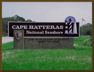
"Cape Hatteras National Seashore extends more than70 miles from South Nags Head to Ocracoke Inlet and includes Hatteras and Ocracoke Islands, covering 30,000 acres. This is the first National Seashore in the country and includes natural and historic attractions, such as lighthouses and lifesaving stations. Picnic, camping and interpretive programs are offered seasonally."
"A thin strand of islands curves out into the Atlantic Ocean and then back again in a sheltering embrace of North Carolina's mainland coast and its offshore sounds. These are the Outer Banks of North Carolina. For thousands of years these barrier islands have survived the onslaught of wind and sea. Today their long stretches of beach, sand dunes, marshes, and woodlands are set aside as Cape Hatteras National Seashore. It can be a lonely place; you may walk along the beach unseen except by shore birds searching for a meal. It can be a place of discovery; you may visit the 1870 Cape Hatteras Lighthouse, one of many monuments to man's encounter with the sea. It can be a wild place; you may be buffeted by an approaching gale or surprised by the honking of large flocks of migrating geese. And it can be an exciting place, where you may explore many opportunities for recreation: surf fishing, sunbathing, swimming, beachcombing, canoeing, sailing, surfing, snorkeling. Part land, part sea, Cape Hatteras offers rewards from each."
"Graveyard of the Atlantic" "The treacherous waters that lie off the coast of the Outer Banks bear the name Graveyard of the Atlantic. It is a grim, but fitting, epithet, for here more than 600 ships have wrecked, victims of shallow shoals, storms, and war. Diamond Shoals, a bank of shifting sand ridges hidden beneath a turbulent sea off Cape Hatteras, has never promised safe passage for any ship. But seafarers often risked the shoals to take advantage of north or south flowing currents that passed hearby. Many never reached their destination. Fierce winter nor'easters and tropical-born hurricanes drove many ships aground, including the schooner G. A. Kohler in 1933. Other ships were lost in wars. During World War II German submarines sank so many Allied tankers and cargo ships here that these waters earned a second sobering name - Torpedo Junction. In the past 400 years the graveyard has claimed many lives. But many were saved by island villagers. As early as the 1870s villagers served as members of the U. S. Life Saving Service. Others manned lighthouses built to guide mariners. Later, when the U. S. Coast Guard became the guardian of the nation's shores, many residents joined its ranks. When rescue attempts failed, villagers buried the dead and salvaged shipwreck remains. Today few ships wreck, but storms still uncover the ruins of old wrecks that lie along the beaches of the Outer Banks."
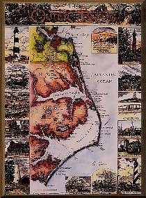
Map of North Carolina's Outer Banks by Ann Sader
Click on this Map to See a More Detailed Enlargement